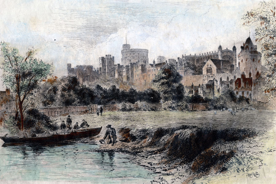
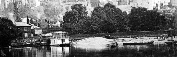
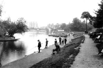
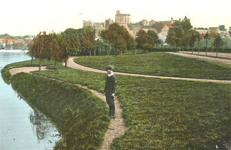
A view across the river from The
Brocas dated 1893 showing the initial stages of
construction of the promenade. To see a similar
view of the promenade after it was first
completed, click here
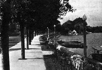
The Promenade at Barry Avenue,
Windsor, was first created in the early 1890s and
has changed several times in the 1900s, reflecting
the increase in the river's attraction as a
leisure amenity rather than purely for commercial
and travel purposes as had been the case in
earlier centuries.
There are records of coal being
brought upstream as long ago as 1367 to the
Castle, and Cotswold stone being transported by
river for the construction of St George's Chapel
in the late 1400s, but with the arrival in Windsor
of the railways in 1849, a new and faster
transport system came into being that was nothing
short of revolutionary. Windsor was not alone in
seeing the riverside subsequently change into a
leisure area with newly created walks
(promenades), coupled with tree planting and the
provision of boat hire and seating areas. There
have been suggestions that Alexandra Gardens
should have extended to the river bank from the
outset, without the roadway (Barry Avenue)
intervening, but it was to be almost 100 years
before plans were proposed (in 2002) to remove the
road and link the gardens to the riverside coupled
with revised car parking areas. See Story. Come 2003 and a
new Liberal Democrat council and once again these
plans were shelved.
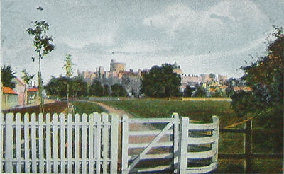
Originally just a sloping
bank to the river, as illustrated in the Herbert
Railton engraving above, the 1890s development
created Barry Avenue following the route of the
path to Clewer Church together with the first
promenade. The avenue was named after Sir Francis
Tress Barry, MP for Windsor, 1890-1906. On the
opposite side of the road, to the south, Alexandra Gardens
was created around 1900.
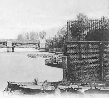
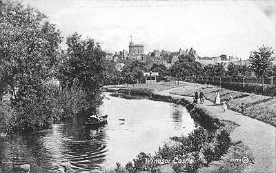
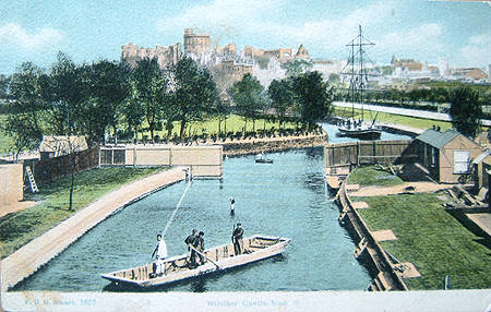
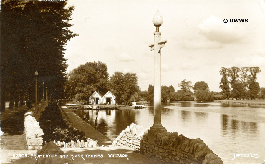
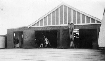
Work in progress [above] on the
new riverside promenade, with the GWR railway
arches beyond and the two boathouses used by
Messrs. Boddy and subsequently by Arthur Jacobs, boat builders
and hirers. It is unclear where these boathouses
were originally built. In this view they appear to
be on the main riverbank , but the boathouses are
on the small island, Jacobs Island, that remains
to this day. The boathouses had disappeared by the
1960s. Photo date approx. 1895.
It is close by on this stretch
of riverbank that the well known steamer, 'Windsor
Belle', was believed to have been constructed in
1901 by E Bourgoine. Later, in 1923, The 'New
Windsor Castle' was constructed on Jacob's Island.
Together with 'The Empress of India' these
launches were a very well known sight on this
reach of the Thames throught the 20th century. The
'Windsor Belle' has survived in lovely condition,
but both 'The Empress' and the 'Windsor Castle'
were eventually broken up in Sunbury in 2005 and
2009 respectively. There is more
about the Windsor steamers here.
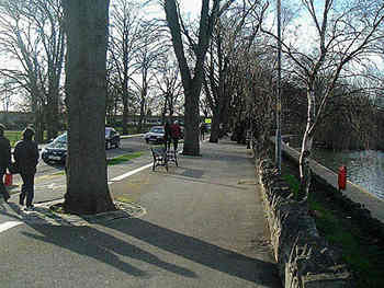 Approximately the same
area of The Promenade, Windsor. February 2000.
Approximately the same
area of The Promenade, Windsor. February 2000.
It is likely that the floods of
1875, 1877 and
1894 had prompted the building-up of the bank as
an early form of flood defence for the town and
refuse and rubble had been tipped for a long
period to raise the road level above that of the
area that was to become Alexandra Gardens.
It was certainly effective because in 1947, when
Windsor was flooded once more, Alexandra Gardens
had to be pumped dry after the floods had receded,
as the waters were trapped behind the embankment.
[The Floods of 1947]
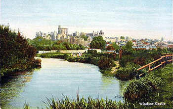
The newly contoured banks formed a
popular relaxation area for visitors and
Windsorians alike, and there have been very many
views published from the mid-19th century and
throughout the 20th century of Windsor from The
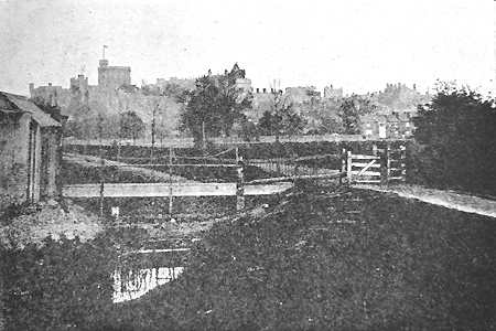
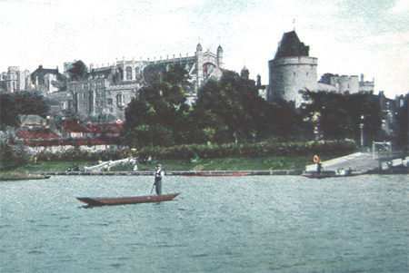
Brocas. The earliest
photograph of Windsor, or so it claims, was
taken from here. See below.
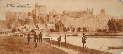
Perhaps the earliest
photograph of Windsor?
It was taken from The Brocas before 1863 when The Curfew
Tower was reroofed.
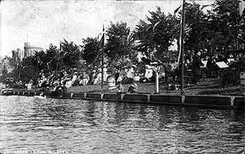
A crowd gathers and
a band plays on the promenade during a
Regatta early in the 1900s
A busy day on the promenade is
illustrated above, showing the sloping grass bank,
flagpoles, young lime trees and barrels planted
with evergreen shrubs. At the top of the bank was
a wrought iron fence and hedge which was to last
until the mid 1930s when further development took
place.
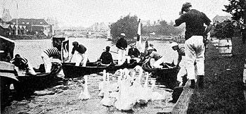
Swan uppers corral
the swans on the promenade in the reign of
Edward VII, c. 1909. Note the wooden
bankside, barrels of shrubs and grassy bank.

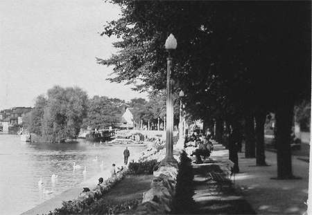
Above is a view to the west,
upstream, in about 1913, when the grass had given
way to a pathway and the barrels
removed. Note the 1908 Dyson Memorial
between the trees above the boys' heads. This is
shown enlarged further down this page. The
boathouses in the distance by this time had now
been relocated on Jacob's Island.
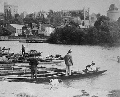
The Ferry to
the Brocas
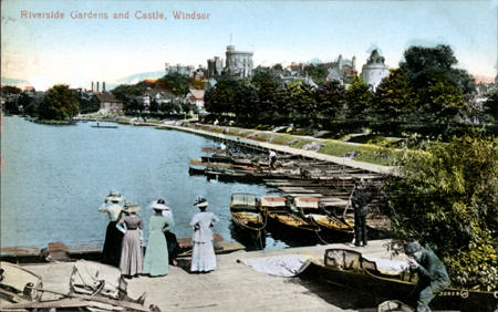
The punts in the foreground
belonged to the ferryman who would take you across
the river to the Brocas. In Victorian times there
was still a toll to be paid when crossing Windsor
Bridge, plus it was quite a detour around the foot
of the castle walls to get to the bridge. At that
time neither Thames Avenue, nor the riverside walk
linking the promenade and Windsor Bridge, existed
and so a quick trip across the river on a punt
seemed an acceptable alternative. In the 1950s I
recall the fare was 3d, three old pennies, or
about 1.5p in today's currency.
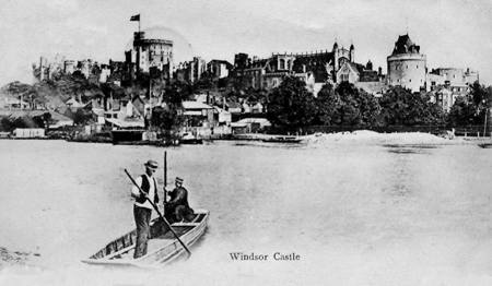
The ferryman poses
midstream for the camera in the very early
1900s. He used a quant pole to propel his
punt across the river by pushing the pole
onto the riverbed. The passengers would sit
on wooden benches along each side of the
punt.
(Extract from a tinted postcard view)
Above is an earlier view of the
ferry from the 1890s, quite possibly of the same
ferryman, with either a passenger holding onto a
pole to steady the punt on the Brocas side of the
river, or perhaps helping the ferryman with a
second quant pole - unlikely! A quant pole is long enough to push
down to the river bed and so propel the punt
across the river at a healthy speed. The joke is
that if the pole gets stuck in the mud of the
river bed, the 'quanter' gets pulled into the
water. The truth is, you let go!
 This image was first
published in 1896 and shows the ferry in the
foreground and his passengers.
This image was first
published in 1896 and shows the ferry in the
foreground and his passengers.
The Dyson
Memorial
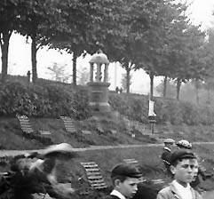 The Dyson Memorial
(Extract from 1913 photo reproduced above)
The Dyson Memorial
(Extract from 1913 photo reproduced above)
The Dyson Memorial was
originally located on Barry Avenue, opposite the
junction with Goswell Road as illustrated above,
but is now located in Alexandra Gardens. The
Memorial, in the form of a drinking fountain,
commemorated Thomas Dyson who had founded 'Dyson
and Sons, pianoforte dealers' in Thames Street in
1865 and who had became Mayor in 1890. Thomas
Dyson actively promoted improvements in the town,
such as the construction of the promenade.
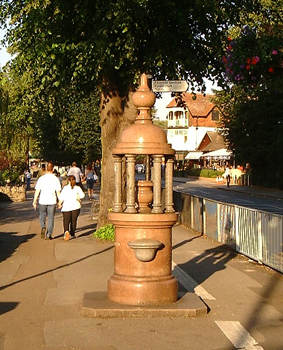 The Dyson Memorial
in August 2002
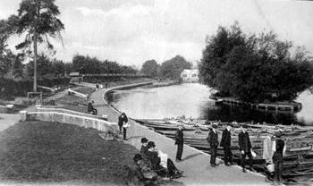
The Promenade
from 1910
 The riverside promenade,
c.1913, looking east.
The riverside promenade,
c.1913, looking east.
In the photograph above there
are clearly two paths and many seats along the
length of the promenade. Also boats for hire are
seen lined up along the riverside.
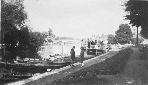
‘Jack and Ivy’ visiting Windsor
A similar view but taken in
1926. Two visitors to Windsor, 'Jack and Ivy', are
seen walking east along the promenade. They had
earlier visited the castle.
Below is another view of the same area
looking upstream. It is hard to date precisely,
but judging by tree growth and the gentlemen's
clothes we estimate 1920.
The promenade
looking upstream, perhaps in 1920
The promenade
looking upstream, perhaps in 1920. Note Jacob's
boathouses in the distance on Jacob's Island. On
the curve of the promenade, in a break in the
hedge, the roof of the ferryman's ticket office
can be seen
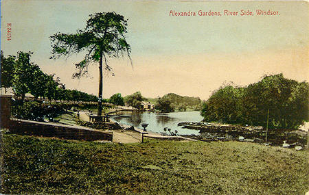
Above: A hand-tinted
version of a similar view. There seems to be a
picnic table constructed around the large pine
tree. The card is titled Alexandra Gardens,
River Side, Windsor, which is not strictly true,
Alexandra Gardens being on the other side of
Barry Avenue. (From a postcard in the collection
of the RWWS, Nov. 2005)
This view above is taken from
Jacob's Island, on the slipway, and looks towards
the promenade. The rowing boats are those of
Messrs Jacob's. the boat houses would be
immediately behind the photographer, to the right
of this view. Approximate date 1910 and published
by Valentine.
Here is the same view with some
colour added by the postcard publisher Valentine.
The colouring artist has also taken the
opportunity to add in some ladies too! The
ferryman is just visible in the distance.
The
Promenade to the West
Downstream
from the Arches
 Barry Avenue and The
Promenade with Jacob's Island to the left.
Barry Avenue and The
Promenade with Jacob's Island to the left.
This photograph is looking east towards the point
at which the 1936 photo was taken.
Below is an earlier view from a similar point.
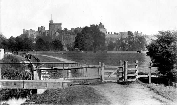
 An 1880s view of
approximately the same area before work on the
promenade was commenced.
An 1880s view of
approximately the same area before work on the
promenade was commenced.
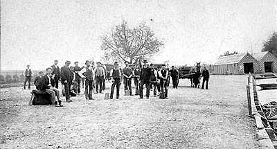
 A photograph taken
adjacent to Jacobs Island with a bridge across to
the island.
A photograph taken
adjacent to Jacobs Island with a bridge across to
the island.
The above photograph was taken
in the 1890s. In the background construction work
is beginning on the promenade.
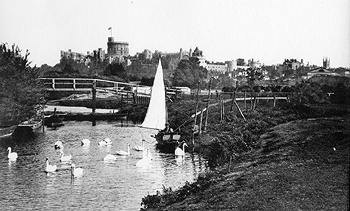
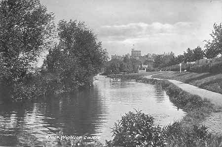
This view is from close by
Jacob's Island looking upstream towards Brunel's
'bowstring' Bridge (GWR to Slough) probably around
1907. The sailing barge is to be seen in a number
of Windsor postcards of the time. (See also [Alexandra Gardens]
where there is a view of the gardens and the
promenade taken from the arches of the railway
line to Slough.
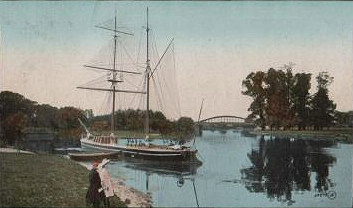
The same location, but
looking downstream. Young willow trees seem to
be planted by the river - see close up below. In
recent years some of these have since fallen or
been felled.
An extract from the
above card showing the young trees planted along
the line of Barry Avenue and what seems to be
young willows close to the river bank. Shortly
after this post card was published the
refreshment kiosk was constructed, illustrated
below.
The same area of The
Promenade, at the western end, near the GWR
railway arches, in around 1912. Baths Island is
to the left.
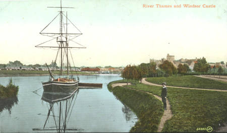
A similar view of
The Promenade a year or two later, perhaps the
summer of 1914. The card is postmarked November
1914. The trees have grown a little in this view
and a lifebuoy has now been installed on the grass
slope. The sailing ship, seen clearly in the
picture below, is just visible moored at Jacob's
Island a short way downstream.
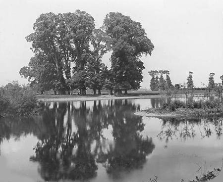
An early photographic
view, probably late 1870s, by George Washington
Wilson illustrating the two islands before they
were joined to create Baths Island as we know it
today. © The Royal Windsor Website 2007
 The Swimming Baths 1904 by
F G O Stuart
The Swimming Baths 1904 by
F G O Stuart
We were delighted to discover
this photograph taken by
F G O Stuart from the railway arch
overlooking the Swimming Baths. The sailing
barge features in a number of other views of this
area including a contemporary view of Alexandra Gardens.
To the left Baths Island seems now to be joined to
Deadwater Ait. In a map dated 1897, the two
islands are shown as separate. Even today, when
the river levels rise, this is the point at which
the water first finds its way across and separates
the islands once more.
The picture shows the reconstruction
in 1904 of the Western Baths beside the railway
bridge after they had been moved downstream, out
of public view, at the request of Queen Victoria
some years earlier. Please see our story The
Windsor Swimming Baths for more information.
Close examination of the picture,
which has been tinted by hand, shows evidence of
construction work continuing. The step ladder far
left, two piles of planks far right, one by a
small corrugated iron hut, and the other by the
fence beside a second hut, as well as the outline
of a wheel-barrow on the pathway to the right, all
suggest 'work in progress'. It is possible that
the large punt-like boat in the centre of the
picture was actually used by the builders to
install the steps and artificial riverbank. Beyond
the area set aside for swimming centre left, the
bank of the former Deadwater Ait has been planted
up with shrubs between the trees. These may have
been planted several years earlier, judging by
their size, We shall continue researching the
history of this area and would welcome any
pointers or references that readers may be able to
come up with.
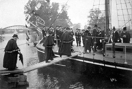
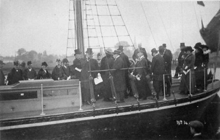
The Sailing
Barge
We have found two photographs
said to date from October 1912 and illustrating
some kind of 'inauguration' with a visit from the
Mayor and councillors and other local dignitaries.
If anyone has any further information we would be
pleased to hear what the background story is.
The 1930s
Improvements to the Promenade
In 1934 plans for further
changes to the promenade were proposed including
the narrowing of Barry Avenue, the removal of some
of the lime trees, the construction of the wall
along the length of the promenade and the
provision of permanent, concrete pathways. In the
photograph below, taken in 1936, it can been seen
that the original tree planting remains complete,
although in the years since a number of trees have
been removed as they matured. The changes were
completed in 1936 and altered the slope to the
bank which was now more sharply 'stepped' with the
construction of upper and lower walls in stone.
Reinforced concrete posts featured electric
lighting within elegant twisted glass shades. Note
that the boathouses remain on Jacob's Island
upstream.
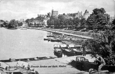
 The Promenade photographed
in 1936, looking west.
The Promenade photographed
in 1936, looking west.
Jacob's boathouses, middle right, are on Jacob's
Island
Here is another view from a
similar position but looking east. Although not
clear in this postcard view, the promenade
extension through to Windsor Bridge has yet to be
constructed, dating this card to within a year or
so of the promenade's modernisation in 1935-36.
The original 'flame-like' frosted glass shades are
clearly visible mounted on fluted columns, made
from reinforced concrete.
The two postcard views above
date from 1938 and must have been taken within a
few moments of each other. To the left the
ferryman can be seen posing rather awkwardly with
his foot on a wall which is just a little too high
for the position to be comfortable! His punt can
be see lower left to take passengers across the
river to The Brocas. The small pleasure boat,
'Avon***' is just visible and would be similar to
'The Angler' and 'Humble' which also offered river
trips to visitors. Once again the pair of
boathouses on Jacob's Island are clearly visible.
At the eastern end the promenade
and steps up to Windsor Bridge were not completed
until a year or so later.

This postcard view shows the
newly completed promenade by the River Street
slipway, but no access further downstream along to
the bridge.
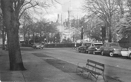
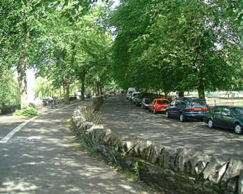
Barry Avenue in the mid-1960s
looking east and the junction with Goswell Road.
Note the car parking at that time was on the far
side of the road. At the time of writing, 2006,
parking is now on the river side of the avenue.
 Barry Avenue and
refreshment kiosk. May 2002.
Barry Avenue and
refreshment kiosk. May 2002.
Some of the 1930s improvements
have since been removed, such as the reinforced
concrete lamp posts with twisted glass shades and
some lengths of the wall, particularly around the
refreshment kiosk, which was altered in 2001.
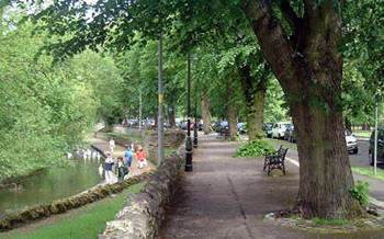
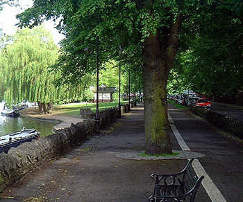
 The view along Barry
Avenue to the east. May 2002
The view along Barry
Avenue to the east. May 2002
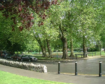 The western end of Barry
Avenue adjacent to the entrance to
Alexandra Gardens.
The western end of Barry
Avenue adjacent to the entrance to
Alexandra Gardens.
Plans were announced in 2002 for
the gardens to be extended across Barry Avenue to
the promenade but these plans were scrapped in May
2003 when a new Liberal Democrat council was
elected. See Car Park
Plans
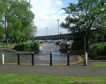 Barry Avenue and the car
park entrance by the railway arches
Barry Avenue and the car
park entrance by the railway arches
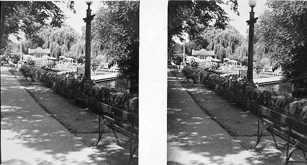
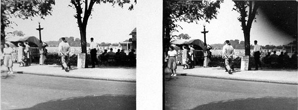
The Promenade
and Barry Avenue in 3D
The following 3D stereoviews date from the 1950s and come from a private, amateur collection.
The three dimensional effect can be seen using a stereoscopic viewer.
The Royal Windsor website has such viewers available from time to time.
To contact us, please email Thamesweb.
 A view of the Café
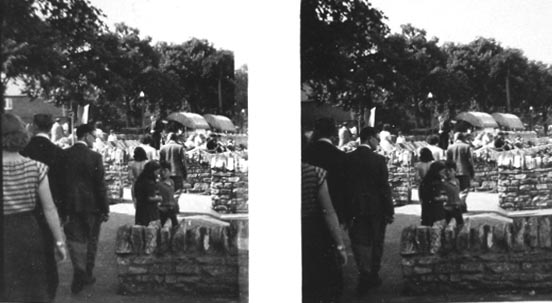
 Barry Avenue and the
Promenade
Barry Avenue and the
Promenade
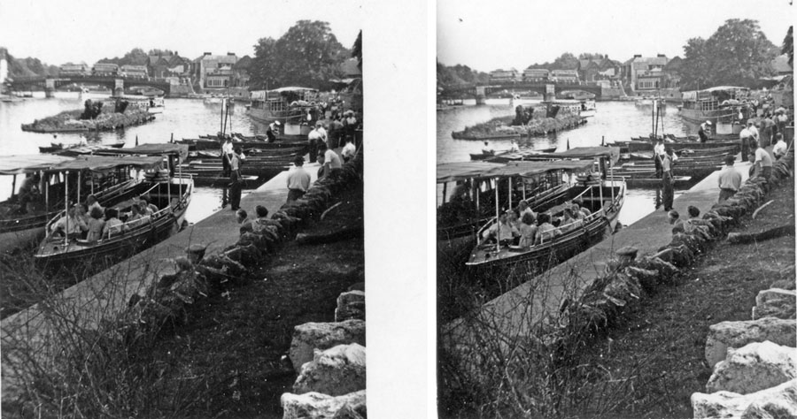 Pleasure launches by the
Prom with a rather bare Fireworks Eyot (Pr. Ait)
beyond
Pleasure launches by the
Prom with a rather bare Fireworks Eyot (Pr. Ait)
beyond
 By the slipway near
theThames Hotel
By the slipway near
theThames Hotel
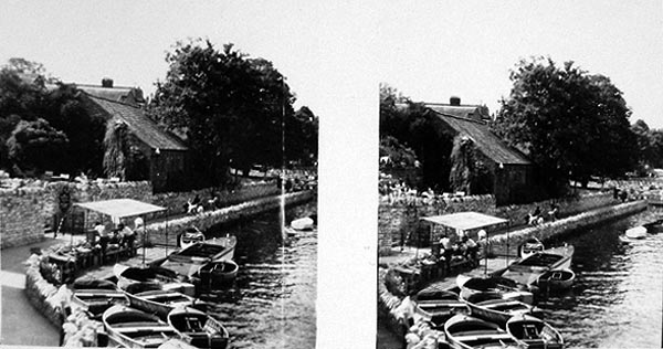 Self drive motor boats
moored at their pontoon by Wren's Old House Hotel
Self drive motor boats
moored at their pontoon by Wren's Old House Hotel
Beyond the
Arches
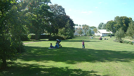 The lawns to the west of
the railway arches where there was a miniature
golf course until the late 1980s.
The lawns to the west of
the railway arches where there was a miniature
golf course until the late 1980s.
The boathouse and Leisure Centre are both visible
in the distance.
In the mid-1930s the riverside
beyond the arches of the GWR railway line, was
known as the stone yard, presumably while the
promenade itself was being modernised at that
time. Later, probably immediately after the war, a
miniature golf course was created on the area,
upstream of the arches, stretching as far as the ISC boathouse. It is
first mentioned in the RBNW booklets of 1949-50.
 The ISC Boathouse in 1937
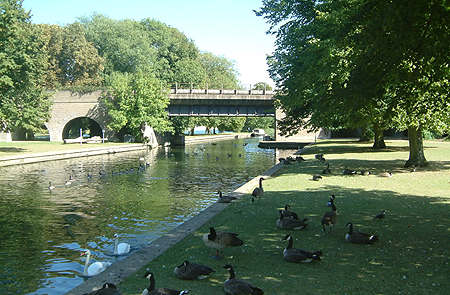 The former baths area
upstream of the railway bridge
The former baths area
upstream of the railway bridge
The backwater by the arches was
used as the swimming baths which ran from around
50 yards upstream of the arches, under the railway
bridge, and extended some 50 yards downstream. A
small foot bridge, variously painted green, silver
or blue through the ages, used to be installed
under the railway bridge. It was later moved to
the downstream end of Baths Island, perhaps in the
1960s, and later back to beside the railway bridge
to allow cruisers access to overnight moorings in
the backwater.
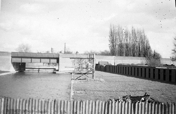
The area of the
swimming baths upstream of the railway
arches in around 1947 before being
dismantled
The lawns are now regularly spoiled by the
presence of Canada Geese. Their droppings, their
webbed feet and the constant grazing all combine
to turn the lawns into a messy morass in wet
weather and not very pleasant in good weather.
This was certainly not the case in the 50s where
the riverside was solely the domain of swans and
ducks. The Canada Geese are a comparatively
recent arrival and should be culled! They
are a nuisance to say the least.
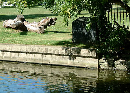 September 2006. The
handrail just above water level
September 2006. The
handrail just above water level
is still visible on Baths Island
Between the miniature golf
course and the swimming area was a grassy slope,
plus a large rockery and an artificial stream
constructed from concrete and stone, meandering
between the putting greens and the pathway along
the river. At one point, close to the boathouse,
the path crossed the stream via a miniature
hump-backed bridge. As a child I recall wishing
that this stream still flowed, though I have vague
memories from the 1950s of each section still
containing water.
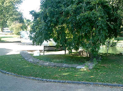 The stonework from the end
of the ornamental stream
The stonework from the end
of the ornamental stream
remains around this tree by the boathouse
Later, perhaps in the 1960s, the
watercourse was filled with soil and planted up,
but with the advent of the Leisure Centre
development, all of this area, including the
putting green, was turned into lawns with a small
shrubbery on the higher ground, near the river,
and which in recent times now features a wooden
bridge.
There is more about the
promenade, with extra pictures
and readers memories, here on the Windsor
Forum
See
also

To
contact us, email Thamesweb.
|